
Airedale Hike San Diego
Airedale Hike
San Diego’s Cowles Mountain, Barker Way trail . . . just a few weeks ago.
Annie had nine puppies his January. Only two of her pups are in San Diego. One Airedale puppy, is in Chula Vista and another is in Oceanside. I’ll be doing a reunion video of Annie and her two puppies in a few months.
Airedale Hike
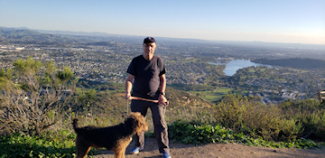
Annie the San Diego Airedale Terrier
Cowles Mountain Barker Way trail
Just six days ago, Teddy arrived at our home from the midwest. Teddy is going to be a larger Airedale Terrier. Teddy’d Dad is 100lbs and his Mom is 65/70Lbs! At eight weeks old Teddy was 15.8Lbs.
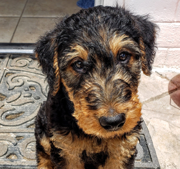
Teddy – larger Airedale Terrier puppy
From Wikipedia, the free encyclopedia:
Cowles Mountain (/ko?lz/, [ka?lz]; properly KOHLZ, commonly KOWLZ) is a prominent mountain located in the San Carlos neighborhood, within the City of San Diego, San Diego County, California. The 1,593-foot (486 m) summit is the highest point of the city of San Diego.
or many years Cowles Mountain was locally known as “S” Mountain. In 1931, 500 students from San Diego State College, now San Diego State University (SDSU), painted a 400-foot-tall (120 m) letter “S” on the side of the mountain, after which it took on its popular name. In April 1942, during World War II, the local military ordered the S covered up for the sake of national security. After the war the painting tradition was resurrected.
In the 1970s, the annual repainting tradition was ceased for environmental and habitat protection, but suffered a brief resurgence in the late 1980s. The “S” has not been repainted for nearly three decades.
Mission Trails Regional Park
The entire mountain, with marked trails, is a protected area within Mission Trails Regional Park, which opened in 1972.
Trails
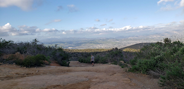
The main trail to the summit is a popular hiking destination taking hundreds of people per day to a 360-degree panorama of San Diego County. The hike to the top is 1.5 miles (2.4 km) long and an elevation change of about 950 feet (290 m). This trail is on the corner of Golfcrest Drive and Navajo Road. A much-less-used but maintained trail begins near the intersection of Boulder Lake Avenue and Barker way. This trail meets the main trail near the summit.
On March 25, 2013 the trails of Cowles were closed for maintenance. The trails were reopened in May 2013 after several improvements to water drainage and rock steps.
++++++++++++++++++
If you are interested in hiking with your dog at Cowles Mountain, here is another video I shot with another camera about the Barker Way trail.
He is swift, formidable, graceful, big of brain, an ideal chum and guard. ….To his master he is an adoring pal. To marauders he is a destructive lightning bolt.”
+++++++++++++++++++++++
Our Airedale Terrier Youtube channel.
****